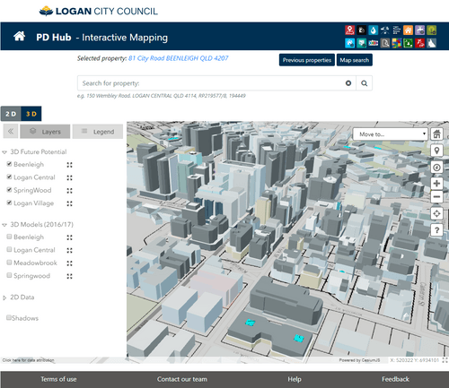
To support development planning of Logan City Council.
Develop a planning platform with data analysis and cartographic components that integrates with the Council’s existing geospatial database.
A range of self-service tools such as an infrastructure fee estimator, environment offset estimator, a rule driven planning enquiry tool indicating where and what type of developments are possible and 2D/3D interactive maps.

Build a land-use evaluation tool with modular design that leverages common digital infrastructure to reduce duplication in planning tools and reduce costs.
Rationalise the various methodologies and tools used across government in to a common database of inputs and assumptions to inform decisions on Government land and property assets in a more consistent, transparent and evidence-based approach.
Reduce the number of related, yet different methodologies and tools used across Government to assess the impacts of different land uses.